 The transportation, agricultural, and construction industries may benefit from the brief long-range weather forecasts that are presented here for January 2010. Of course anyone can benefit from a little advance knowledge of approaching weather patterns. This list of locations and dates for stormy periods is by no means comprehensive. Here’s wishing all my readers a Merry Christmas or Happy Holidays, and a Happy New Year.
New England
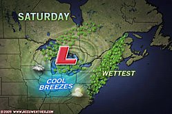
January 4-5, 2009
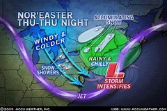
There is strong potential for a Nor’easter type storm to hit the New England area with cold, snow, and windy conditions.
East U.S.
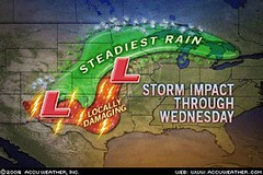
January 13-16, 2009
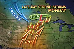
A major winter storm is indicated for the Great Lakes area southward through the Ohio Valley and into the Southeast. High wind, snow, and falling temperatures assail the area. The storm then moves into the Mid-Atlantic and the Northeast disrupting travel and causing power outages.
January 27-31
Another significant winter storm forms over the East Central States (Michigan southward to the Gulf Coast). By the 29th and 30th, storm warnings should be posted for New York, New Jersey, Pennsylvania, Maryland, and Delaware as the storm moves eastward into New England.
Mississippi Valley
January 10-12
A storm system or front affects the southern Plains and Upper Mississippi Valley.
January 25-27
A strong low pressure area is shown over the central Mississippi Valley.
January 29-31
A strong storm system is indicated over the Mississippi Valley with an area of severe weather over Mississippi and Alabama around the 31st.
 Plains
January 4-5
A storm system develops along the east side of the Rockies as moist air, drawn from the Gulf, collides with cooler air from the north. One scenario is that the storm system ejects into the Plains bringing cold and windy conditions behind the low. Or the cold and windy conditions may be the result of a front stretching from the central Plains to the western Great Lakes.
January 7-10
Warm, moist air begins to move northward over Texas and the southern Plains around the 7th bringing a chance of showers. By the 9th, the potential for storminess is heightened. Most of the activity may be over Texas.
January 26-27
Cold air invades the Plains out of Canada creating stormy conditions as a powerful cold front pushes westward.
Rockies
January 2-5
The arrival of warm, moisture-laden air over the Rockies on the 2nd and 3rd will battle with a cold Canadian air mass resulting in windy conditions or a storm center producing winds.
January 7
A sharp cold front pushes southward over the Rockies lowering temperatures.
January 10
A trough of low pressure digs into the southern Rockies.
January 21-22
A fresh push of cold air over the Rockies will react with its warm, moist counterpart resulting in a storm system.
January 24-25
Another period when contrary air masses clash over the Rockies resulting in showers.
West
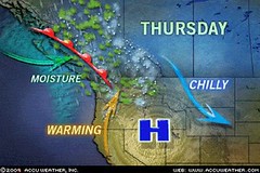
January 13-16
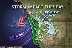
Inclement weather will plague the Intermountain West as a strong front or low pressure area ushers in wind, rain, and snow.
January 21-24
Another batch of wind and rain heads toward the Pacific Northwest and into the Intermountain West.
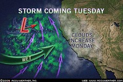
January 26-31
An active weather pattern develops off the Pacific Northwest coast and hurls wind and rain in Washington, Oregon, and California. It appears that a number of fronts will ride through the area between these dates and push into the Intermountain West.
Introduction to the Weather Alternative
How Long-Range Forecasts Are Made
Christmas and New Year's Weather Forecast United States and Europe
Super Bowl Sunday 2010 Weather Forecast
Saint Patrick's Day 2010 Weather Forecast
The Case Against the Case Against the Virgin Birth
By Jeremy Lott
Every year at about this time, readers can count on a few Christmas-themed articles appearing in newspapers and magazines that question the Virgin Birth of Jesus Christ. It really is something to see the wide variety of people who get worked up over this ancient Christian belief.
Read more...